Thursday, April 24, 2008
Fort Hancock, TX to El Paso, TX
55 miles (2824 total miles)
We decided to go with Hwy. 20 and 76, the Adventure Cycling roads, rather tha I-10 today, and it really wasn't at all bad. They were smooth and had very little traffic (until we got closer to El Paso) and were definitely more interesting than I-10 had been. We went past lots of small farms, many of which had irrigation ditches along the road and various kinds of locks and sluices to move the water around. There was also a large reservoir which apparently feeds the irrigation ditches; how it gets filled, we have no idea. We got an early morning view of the lights from the Mexican towns along the border (first picture below), and were able to see some houses on the Mexican side, nestled under the mountains. We never did see the Rio Grande but apparently there's not much to see in most places. Tomorrow, we'll actually cross the Rio Grande a couple of times, when it's between Texas and New Mexico. We saw acres and acres and acres of pecan trees, some of them in standing water with ibis and egrets walking around in the water. Haven't seen many shore birds since we left the Gulf area, weeks ago.
We also passed through a few small towns, which is always interesting. The area between Fort Hancock and El Paso seemed fairly prosperous, not wealthy certainly but doing quite well. A historical marker described the economic ups and downs of one of the towns - Tornillo. It did quite well growing cotton, and judging from the tufts of cotton we saw along the road for many miles, they still grow cotton here, but the only crops we saw growing and/or advertised for sale were pecans, hay and alfalfa. Tornillo seemed to be the most interesting town along this stretch, but we ate a mid-morning snack in the town of Fabens and met another couple of bikers, Bill and Fred, from Washington State. They came in for some coffee and we chatted about the routes and different variations we'd made. They were going eastward, of course, and told us of a way around the huge mountain we'll be climbing this week, but Pat seems to have his heart set on seeing the Emory Pass. So I guess I'm doomed.
Our last town before El Paso, Socorro, was much larger than we expected. It had a number of big shopping malls, which looked much like shopping malls everywhere in the States, except that these had a distinctly Spanish/Mexican flavor. Traffic got heavier starting in Socorro and the edge of town coincided with the start of El Paso. It was another 15 miles, though, before we got to the center of El Paso, our night's destination. El Paso was interesting in that it had a major point of entry with Mexico. There was a big bridge connecting the two countries; traffic coming into the US was backed up waiting to go through Immigration. There was a walking lane over the bridge and we saw several people using it. The mountain we'd been seeing in the distance a lot of the day turned out to be right in El Paso, splitting the town in two, with cell phone towers along the top of it. We rode through several suburban subdivisions getting into town, and then got into a lively town center, with lots of people walking around. The town seems to close up after 5, though; we had a hard time finding a restaurant open when we went out after 6 for dinner, and there were substantially fewer people around.
Another interesting part of El Paso we rode by was the Chamizal National Memorial. Chamizal was an area that was under contention between the two countries for many years, as a result of the Rio Grande changing course and carving out a large chunk of land that was in Mexico but ended up on the US side of the river. The National Park Service established a park on the land that ended up American after the final negotiations. Tomorrow, we'll follow the Rio Grande up into New Mexico, and finally leave Texas behind.

A string of lights marks the Mexican towns at the edge of the Rio Grande |

A church in Fort Hancock |

A farm on this side of the river, and mountains on the other |

Mexican houses at the foot of the mountain |

Taking a picture of one of the irrigation ditches |

A sluice in the ditch on the other side of the road |

A grocery store in Acala, the first town we came upon |

Remaining walls of an adobe house |
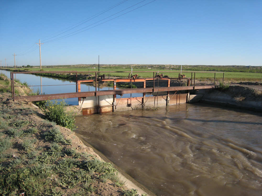
A larger irrigation ditch, with water roiling through one part of the lock |

An irrigation canal going from the ditch through the field |

Pumps used to move the irrigation water |

Deep, straight furrows marked many of the fields |

A tractor chugs across a field, grain silo and farm buildings in the background |

A close-up of the tractor |

A huge reservoir |

We can't say they didn't warn us |

Trees along the road... |

And a close-up of their flowering tips |

Some work still done by hand |

Baby pecan trees |
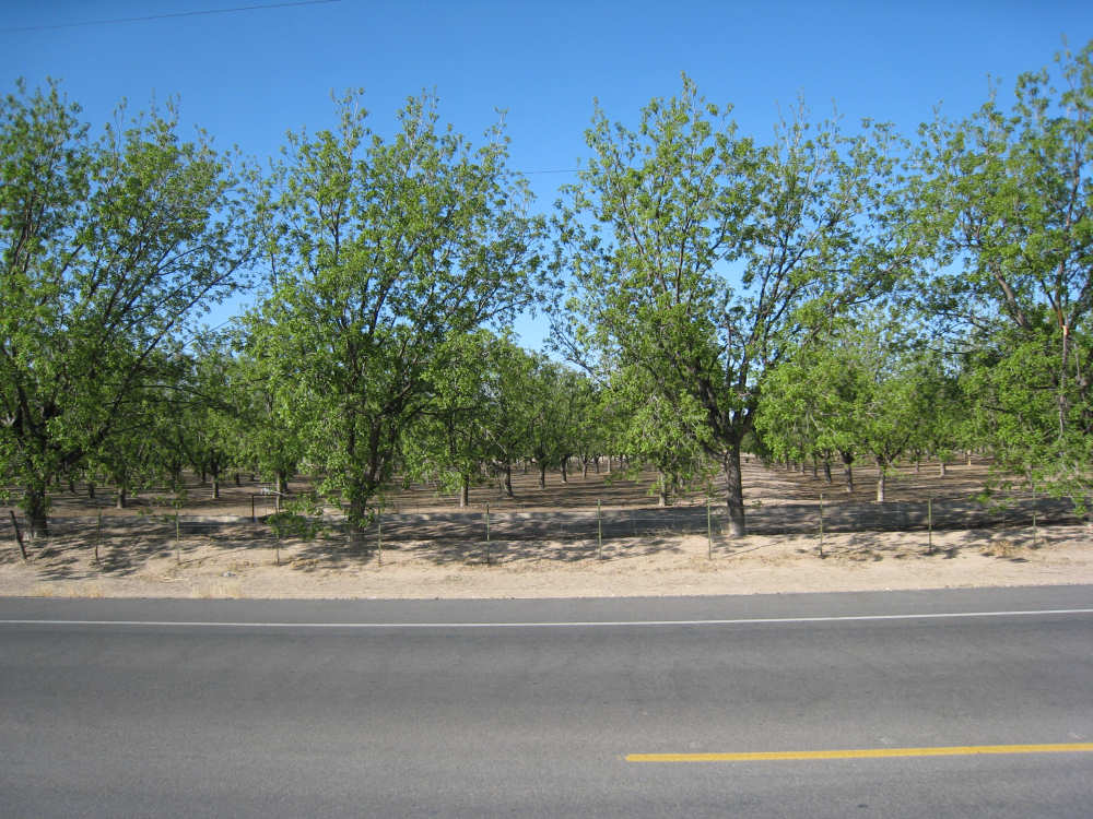
Older pecan trees |

Pecans are not to be messed with |

A sluice for irrigating the pecan trees |

Another crop coming up, we believe it's alfalfa |

The history of Tornillo |

A house in the town of Tornillo |

Interesting concept - a drive-through beer store |

Another odd store in town |

A John Deere store - lots of new farm equipment on display |

Old, but brightly painted, farm equipment in front of a home |

One store had at least a dozen small planes in pieces around it |

An elementary school in Fabens, with a class of kids doing exercises in the pavilion |

Our new friends from Washington, Fred and Bill |

Another restaurant in Fabens |

Brightly colored trailer and other houses |

We saw several of these cute little green things with caps on them... |

and finally found out what they were (but still don't know how they work) |

Flooded pecan trees with what seem to be glossy ibis foraging in the water |

Another flooded field, this one frequented by egrets |

A lovely oleander bush |

A shopping center in Socorro |

A mural on a pillar in the shopping center |

Someone filling a water jug at an Agua Express structure |

A shopping strip across the street |

The city limits of El Paso border Socorro |

The traffic thickens |

Stone walls like these bordered many housing developments |

Brightly painted bus stops |

An interesting store |
Many houses had cement front yards with a few trees or plants |

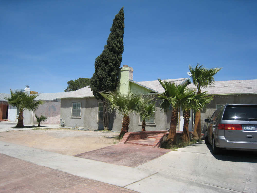
Bright colors abound in El Paso |

Another more well-to-do house |

Two murals on different sides of a community center |

|

The bridge coming into the US, backed up with traffic - a Border Patrol |

The bridge into Mexico, walking lane on this edge |

The entrance to the Chamizal National Park |

Just inside the Chamizal Park |

A vibrant park in downtonw El Paso |

Buildings downtown |