Sunday, July 13, 2008
Augusta, MT to Great Falls, MT
66 miles (6015 total miles)
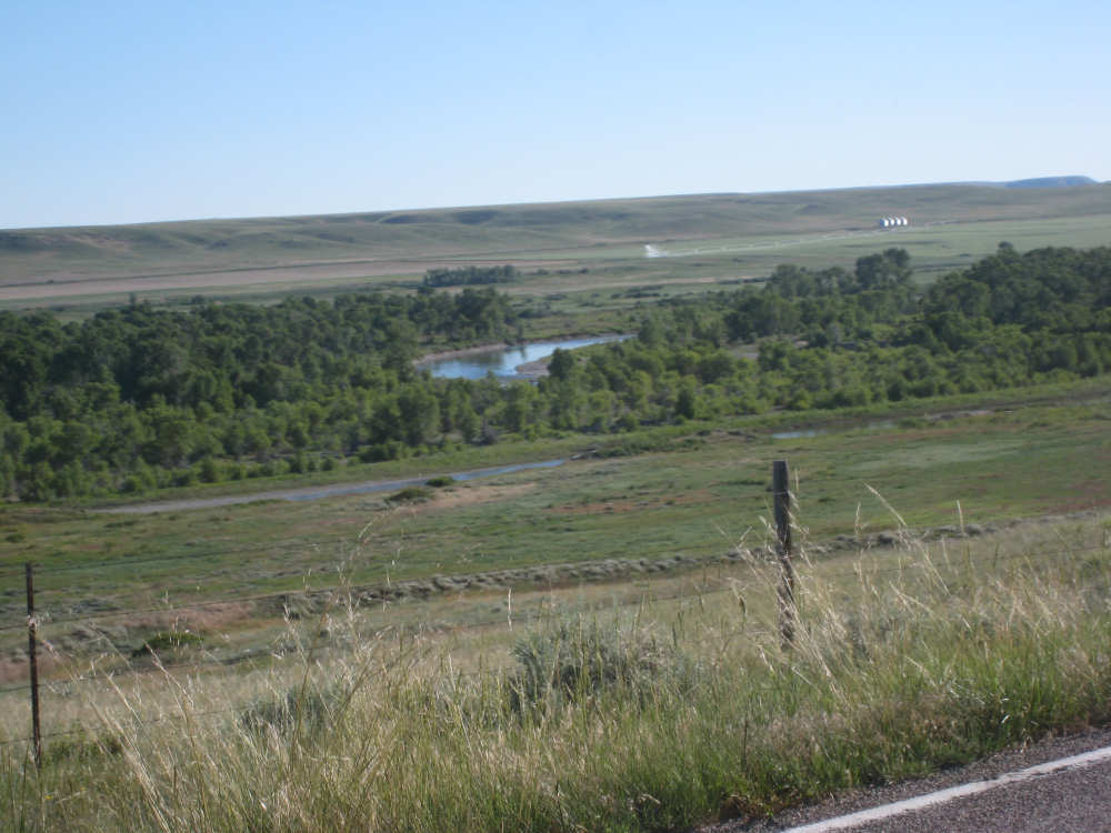
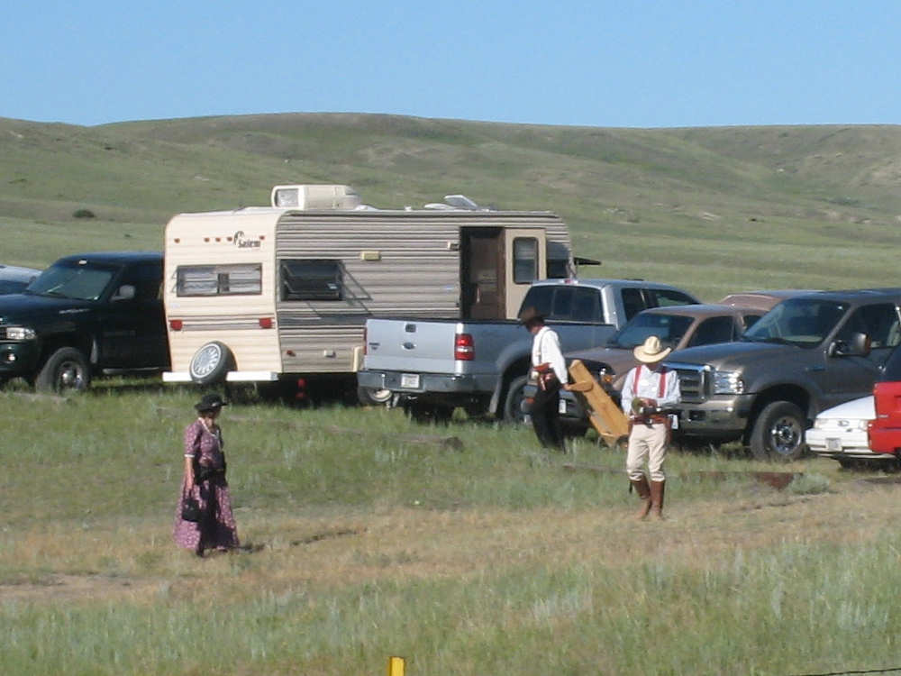
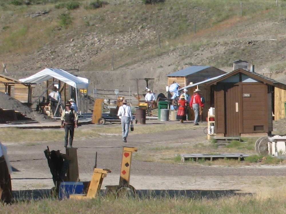
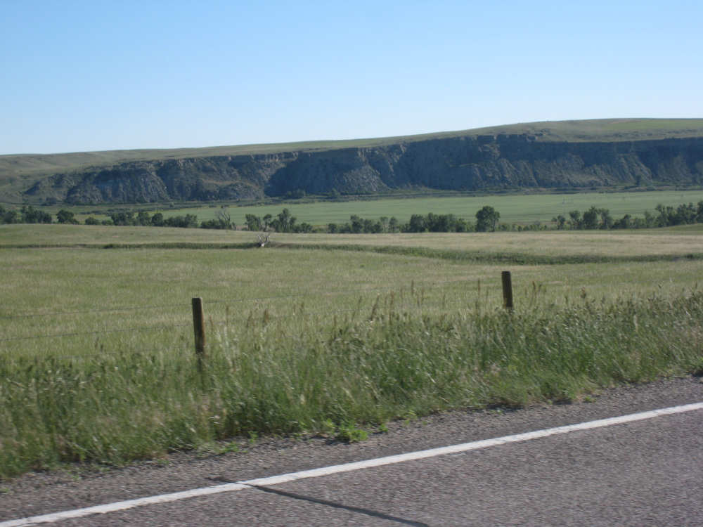
Downhill with a tailwind - definitely our favorite way to bike! And today, that was what we got and it was wonderful. We started out at 7:15 after eating breakfast at Mel's Diner in Augusta and taking a few shots of the town highlights. It was warmer than usual this morning, about 50 or so, compared to yesterday's 35 degrees, and warmed up nicely. It got pretty hot eventually but wasn't uncomfortable - maybe because it was dry or maybe we were moving fast enough to create a cool breeze. We turned onto Hwy. 21, a 2-lane, no-shoulder but no-traffic road that went gently downhill for its full 22 miles, with just a few rises to keep it interesting. There were no towns on that stretch, just lots of sweeping terrain, covered with grasses, with some short cliffs (mesas? buttes? not sure what to call them), the Sun River off to our left, lined with trees and occasionally popping into view. Absolutely beautiful, we just drank it all in so we rolled easily along. Part-way along, we saw a cluster of RVs and trailers along the side and wondered what an RV park would be doing there. As we got closer, though, we noticed the people milling around were in fancy cowboy dress and heading for an area with little sheds done up like an old Western town. There seemed to be shooting targets set up, too. We figured it must have been a shooting competition about to start or some kind of wild-West enactment about to be played out.
We were sorry to leave that road as we rejoined Hwy. 200 at the little town of Simms. Hwy. 200 wasn't bad - it at least had a shoulder but also a little more traffic and there was less terrain and more houses and ranches, so not quite as scenic but still pleasant. Simms was a one-store town (gas/restaurant/grocery store all in one) but the store didn't open until 10 on Sundays and we got there a little after 9. But no matter, we weren't really hungry yet and there was another town in 5 or 6 miles - Fort Shaw. Well, Fort Shaw had one cafe but it was closed on Sundays. It did have an interesting historical marker, though. Then, in another 5 ot 6 miles came Sun River with another historical marker and a convenience store that was open (it was now about 10). We got some ice cream and soda there. We were also thrilled to note we had come 33 miles in just 3 hours, pretty remarkable for us. 9 miles later we got to the big town of the area, Vaughan, population 700. It had an actual restaurant where we had lunch.
Hwy. 200 joined Interstate 15 right after Vaughan and we turned onto a frontage road that ran parallel to it for the 11 miles left to Great Falls. The frontage road had a number of interesting sights along it - windmills along a ridge in the distance, a casino with live poker, a livestock auction site (no auction going on, though), a view of the Sun River going off to the side. It was not long before we reached the city of Great Falls and turned down the road to our motel. We arrived there at 1:30 having gone a little over 53 miles in about 4 hours and 10 minutes of bike time! This must be a record for this trip. Although we were hot and sweaty and could easily have just called it a day, we decided the nearby sights were too good to pass up, so we took all the baggage off the bike and set off for the Great Falls. We soon came to the Missouri River which will be our neighbor pretty much until we reach St. Louis, Missouri. We will be following it more or less for the rest of Montana and through the Dakotas and all through the Midwest states. After we crossed the river, we got onto a bike trail that ran along the river, some of it apparently on the old railroad bed that ran through there. The trail was well-used, there were a number of other bikers as well as walkers and there were picnic areas, pavilions and a skateboard park, all of which were being enjoyed by a number of people.
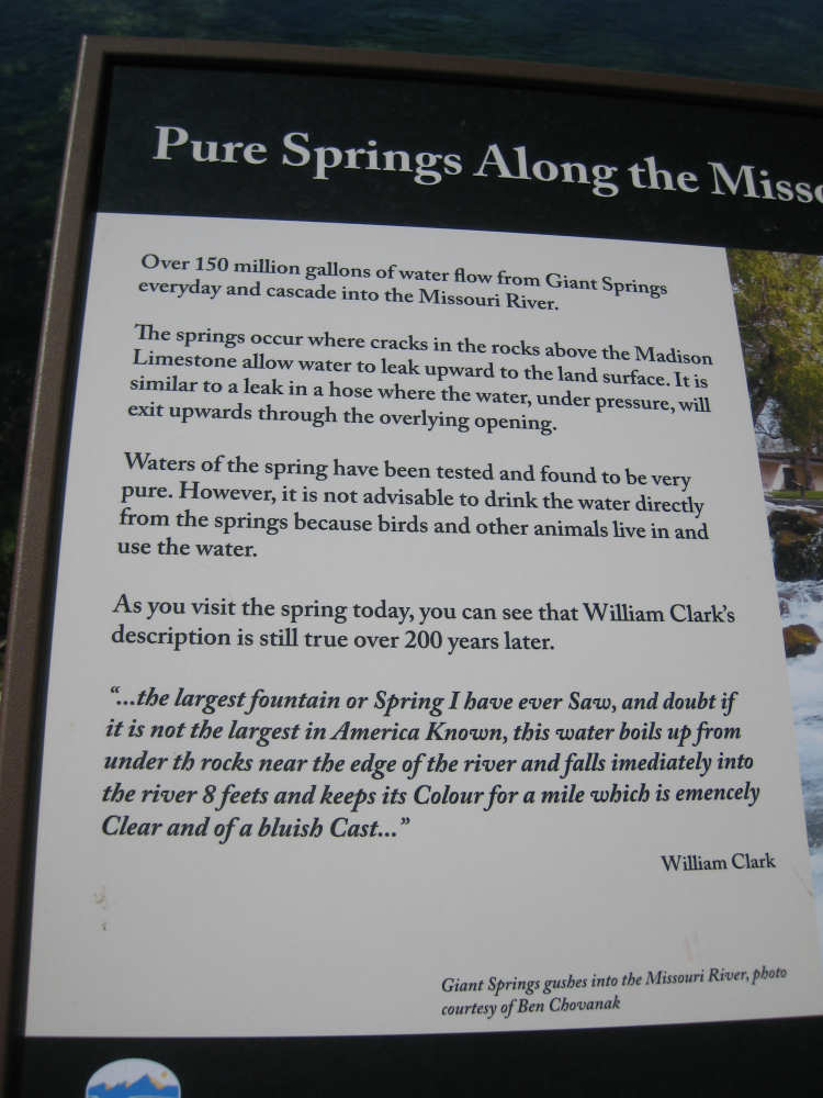
We soon came to the Great Falls area, which were not at all what we expected. The Falls were wide and fairly low, with a lot of water passing over them. I had expected them to be really high and wondered why the Lewis & Clark expedition found them so difficult to get around. We traveled on to the Lewis & Clark Interpretive Center - a museum about the expedition which was fascinating and very informative. It explained, among other things, why it was so difficult - it was not just the Great Falls, it was a series of falls in a row as well as very rough terrain that had the party take an 18-mile detour around the area. The museum described the stuff that the men took with them, about 30 tons of stuff all together, including food, clothes, guns & ammo, things to trade with or give as gifts to the Indians, journals, maps, navigation and surveying instruments, and on and on. Made me feel better about all the stuff we packed for our trip! We could have spent hours there but wanted to get back before too long, so we headed out a little further down the trail to the Giant Springs. This was another sight that amazed Lewis & Clark - a large cold-water spring that gushed out of the ground right next to the river. The water was incredibly clear and a constant 55 degrees. The plants growing under the surface could be seen as clearly as if they weren't underwater at all.
We then rushed back to our motel, stopping for some dinner on the way. We had added another 13 miles to our day, ending at 66 miles in under 5-1/2 bike hours. Even without the additional miles on our sight-seeing excursion, we had reached another milestone - 6,000 miles! A full two-thirds of the trip! However, we are saving our celebratory picture for tomorrow when we'll be at the Missouri River again (yes, we could have done it this afternoon when we were there, but we didn't bring an important prop with us). We figured it was too important a milestone to take the picture at a motel.
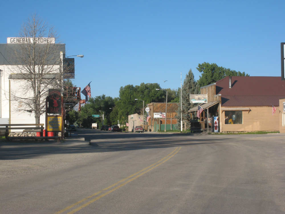
Main Street in Augusta, Montana |
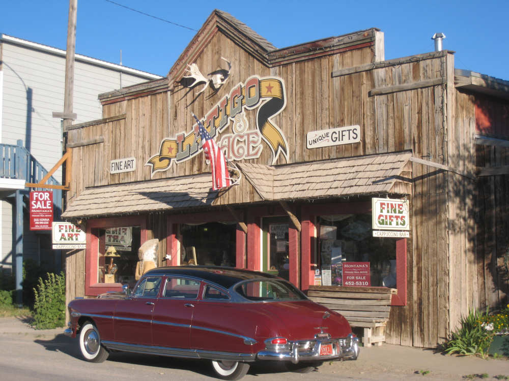
An amazing old car in front of a fancy store |
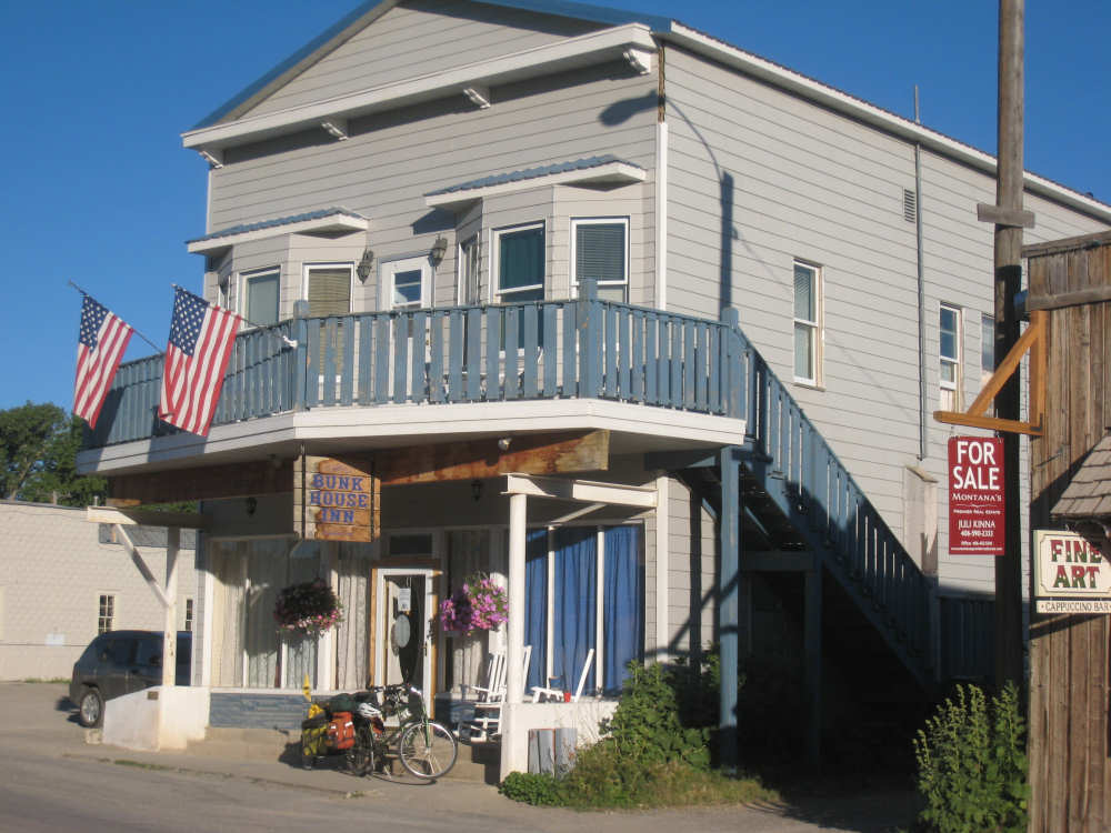
Our comfy bunkhouse |
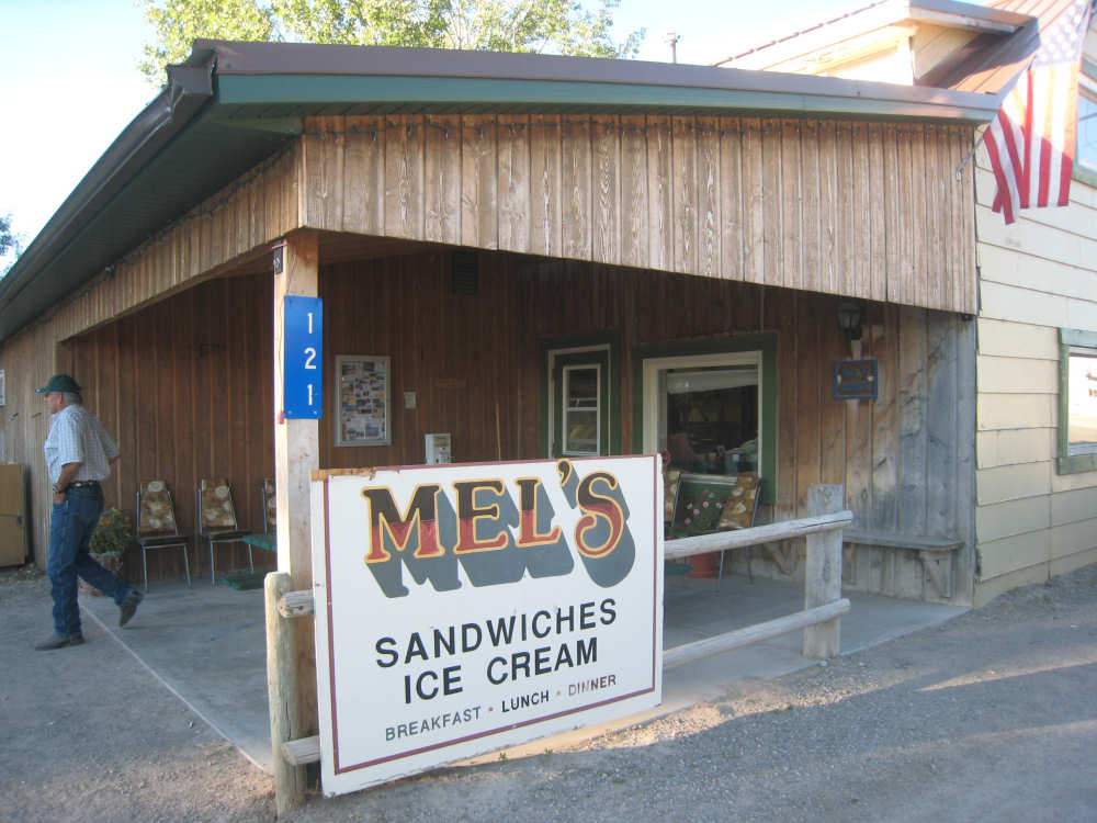
Our terrific breakfast place |
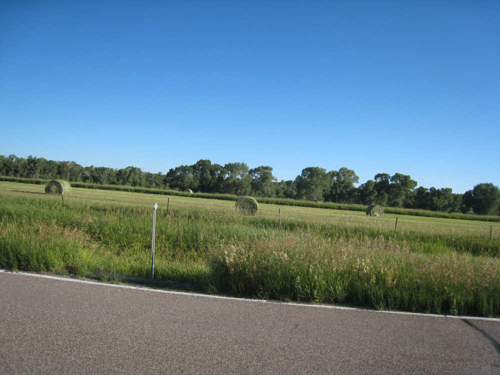
Route 21 - hay bales in a field; the far trees hide the Sun River |

Miles of hay with a distant farm house |
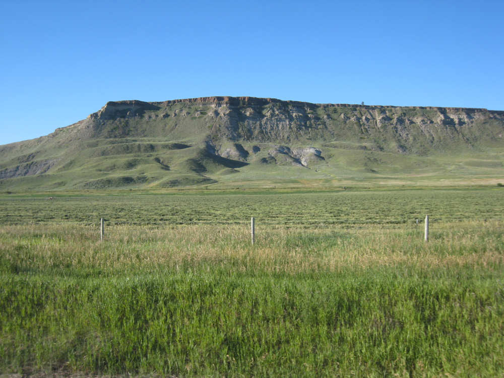
Some intriguing cliffs |
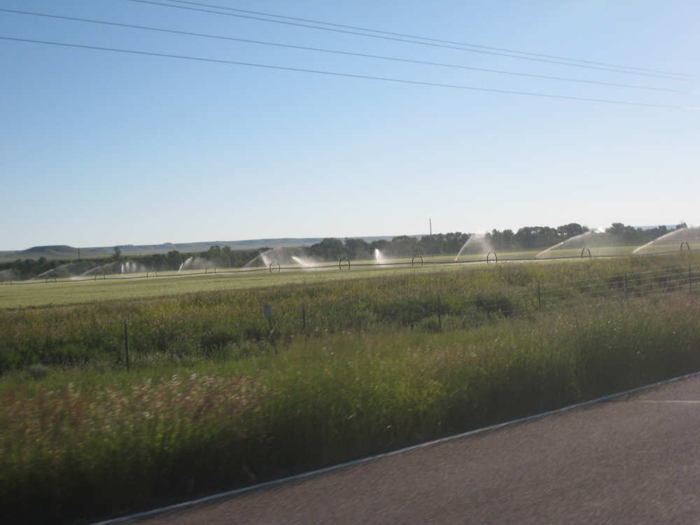
Sprinklers dancing across a hay field |
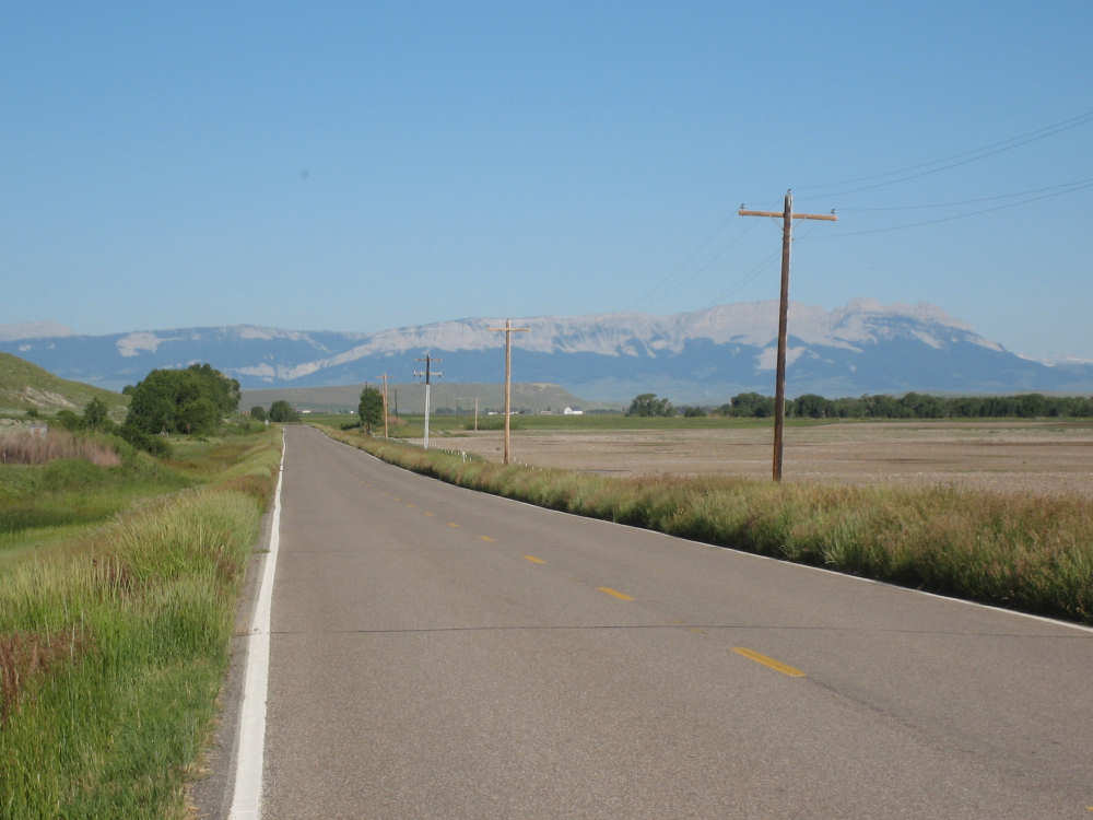
One of our last views of the Rockies as they fade into the distance |

Gracefully rolling hills |
A brief view of the Sun River |
Some of the participants in the shooting competition (or whatever it was) |
People bustling about the sheds set up for the competition |
Cliffs to the north of us, beyond the river |
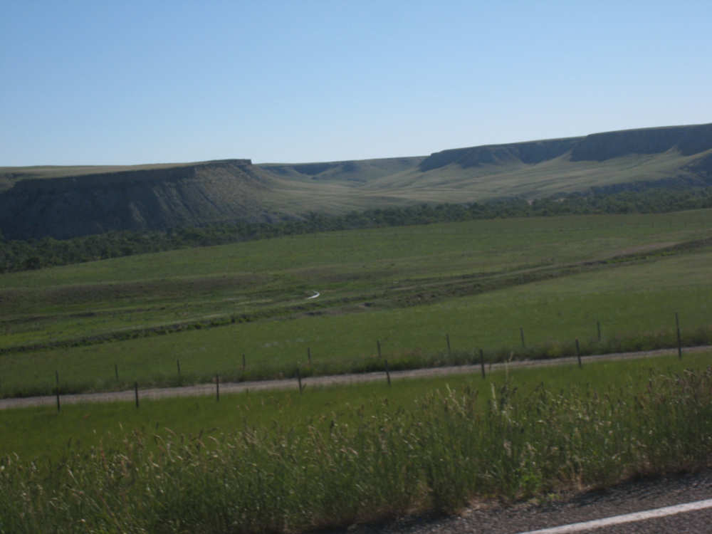
Interesting mesas rise up out of the plains |

History at the town of Fort Shaw... |

and at the town of Sun River |

A small bison herd in a ranch along Hwy. 200 |
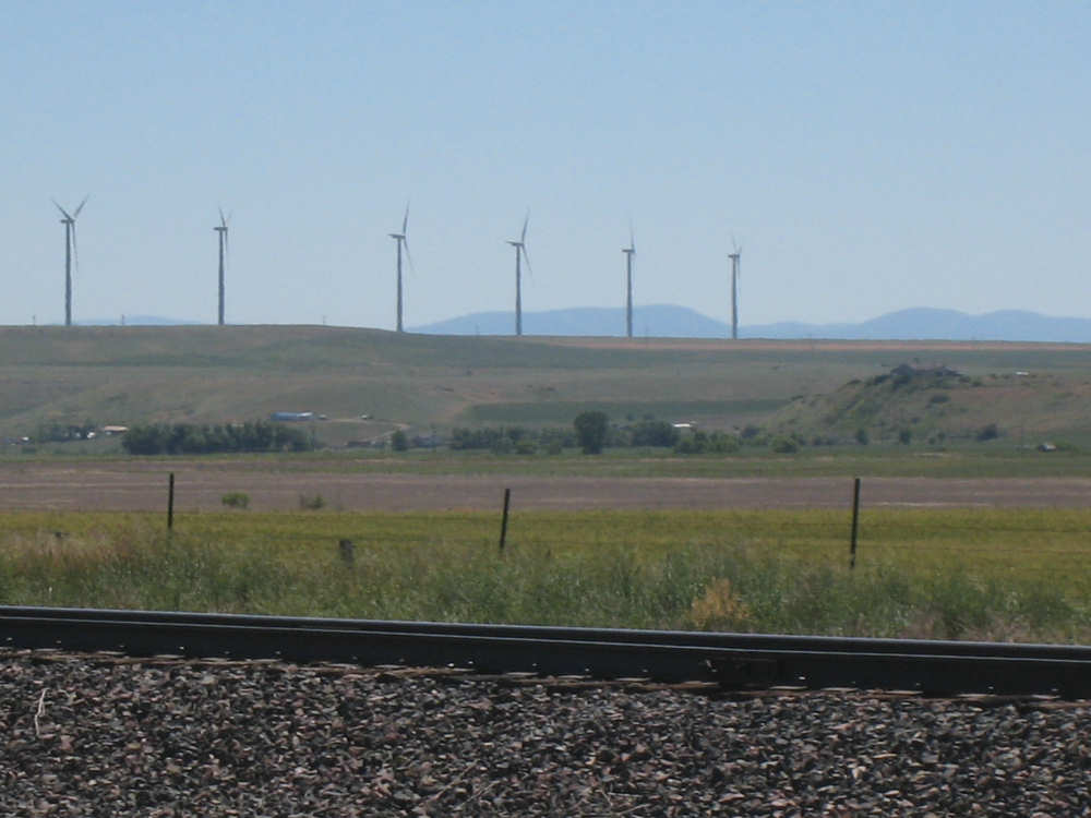
Windmills along the Frontage Road after Vaughan |
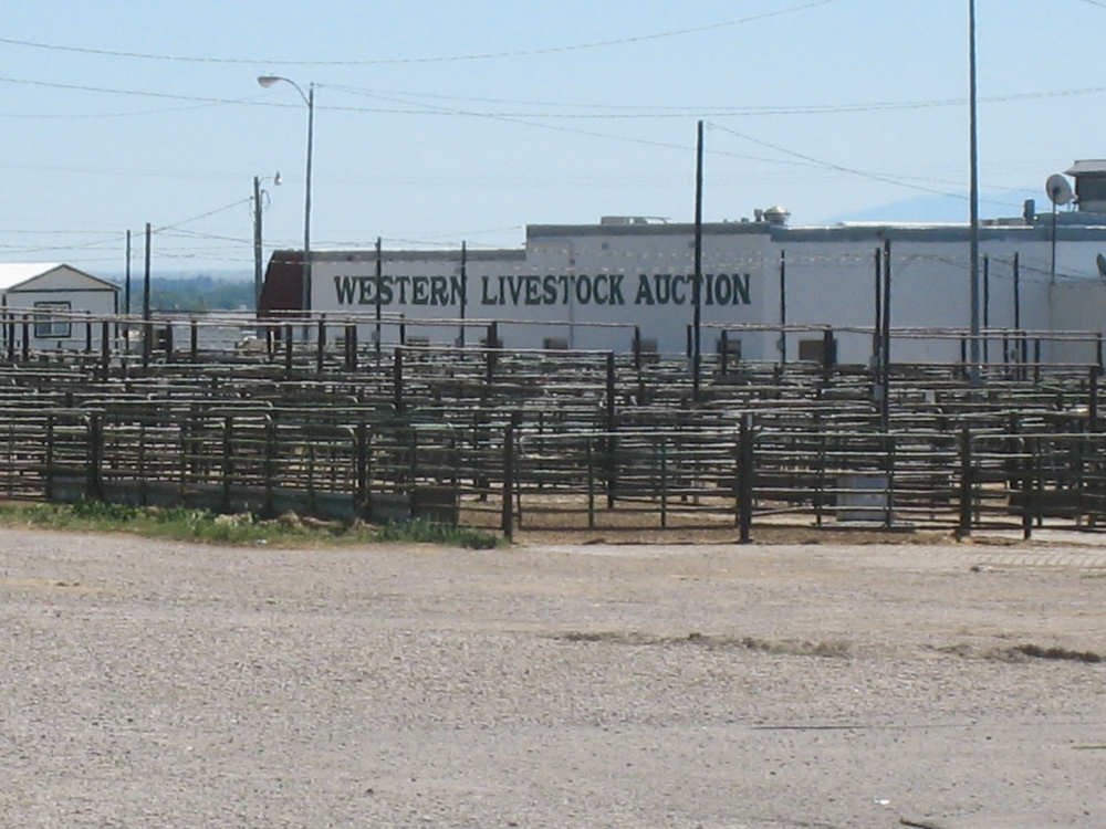
A livestock auction area |
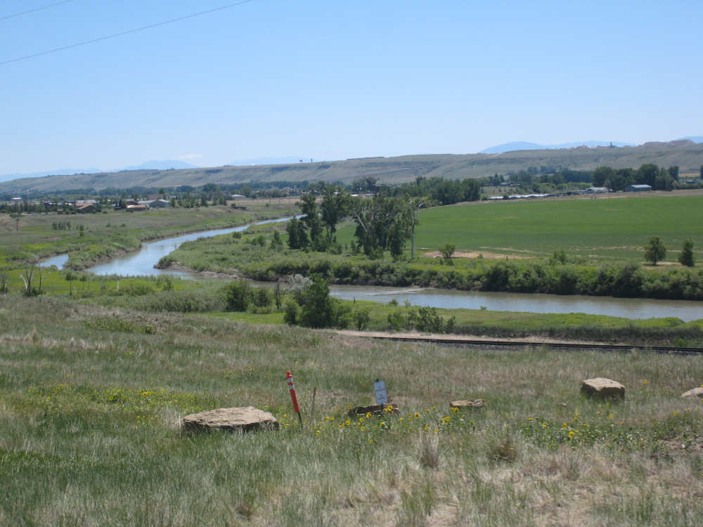
The Sun River meanders along |
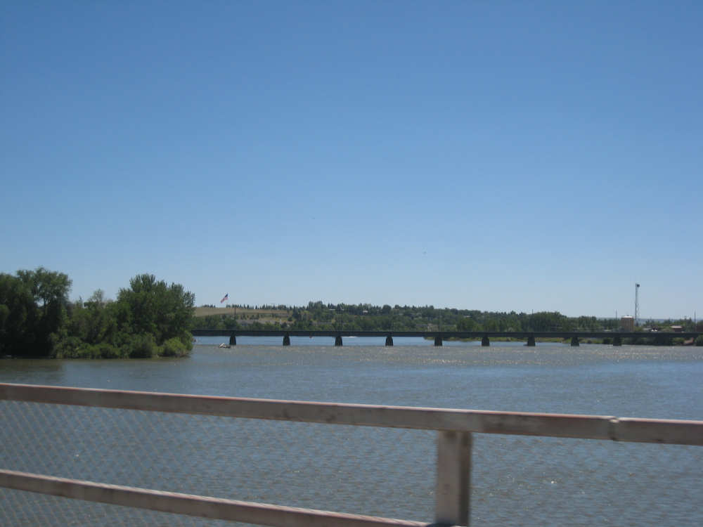
We cross the Missouri River in the town of Great Falls |
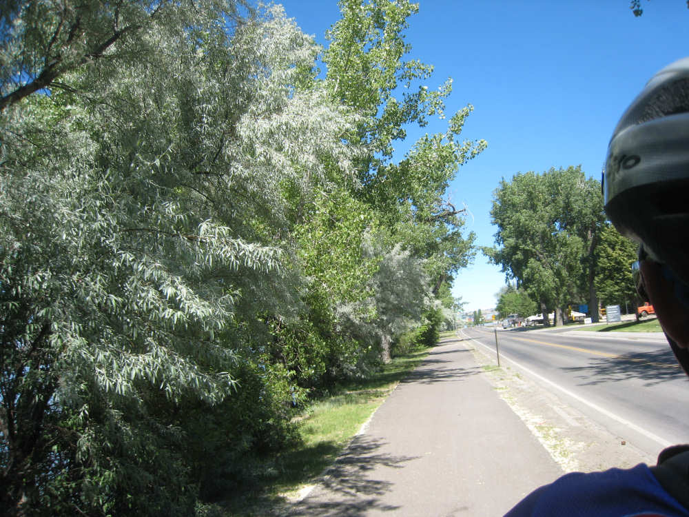
The start of the bike trail along the river |
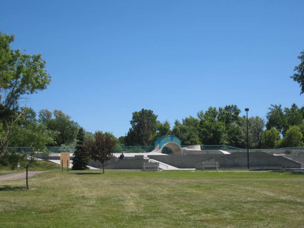
The skateboard park along the trail |

A picnic pavilion along the river |

A giant, cracked Easter egg by the side of the trail! |
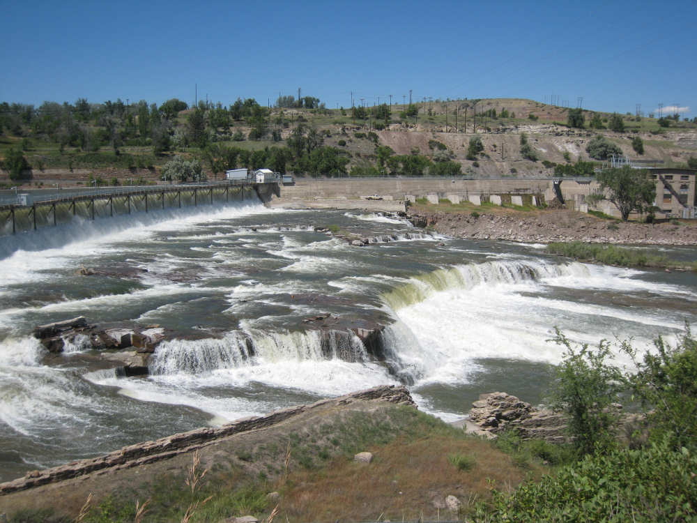
The Great Falls |

A plaque about the minerals in the area |

A plaque about the railway through Great Falls |
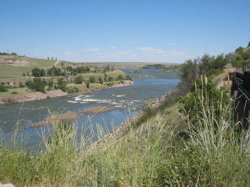
The Missouri, down-river from the Falls |
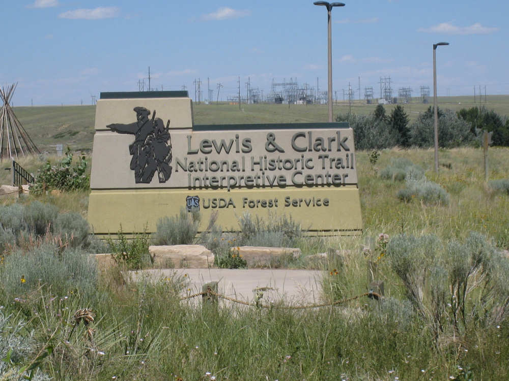
Outside the museum |
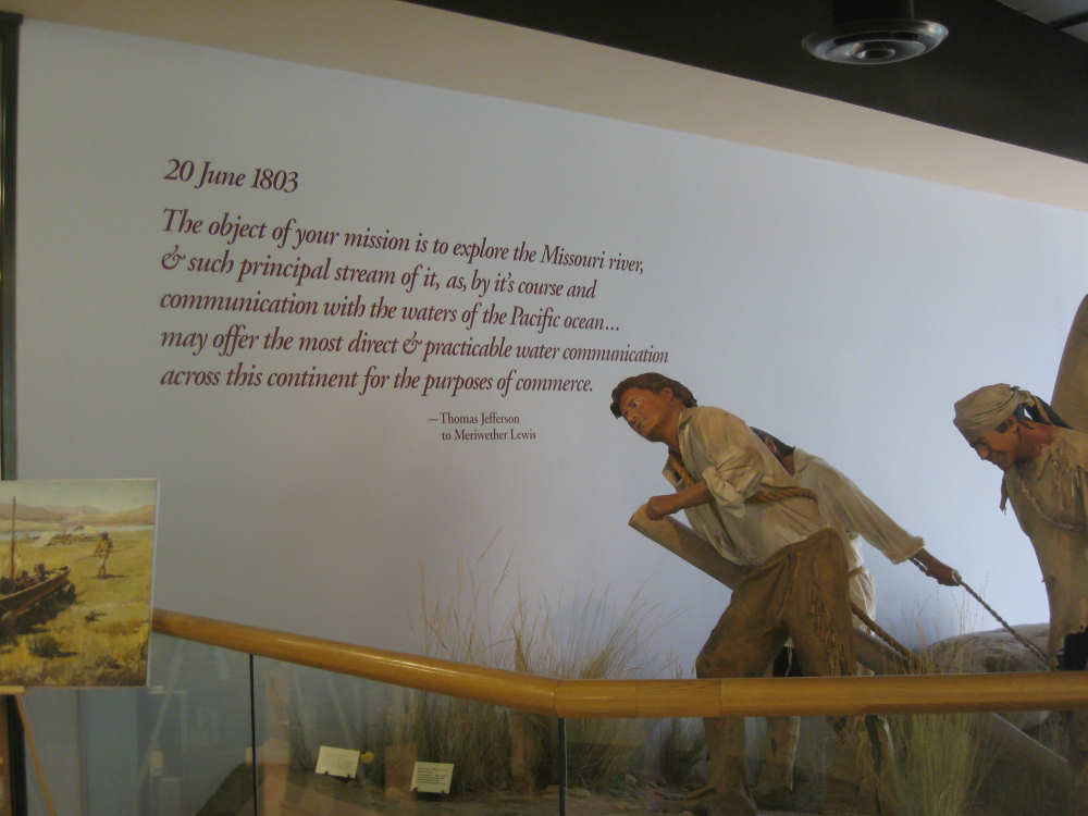
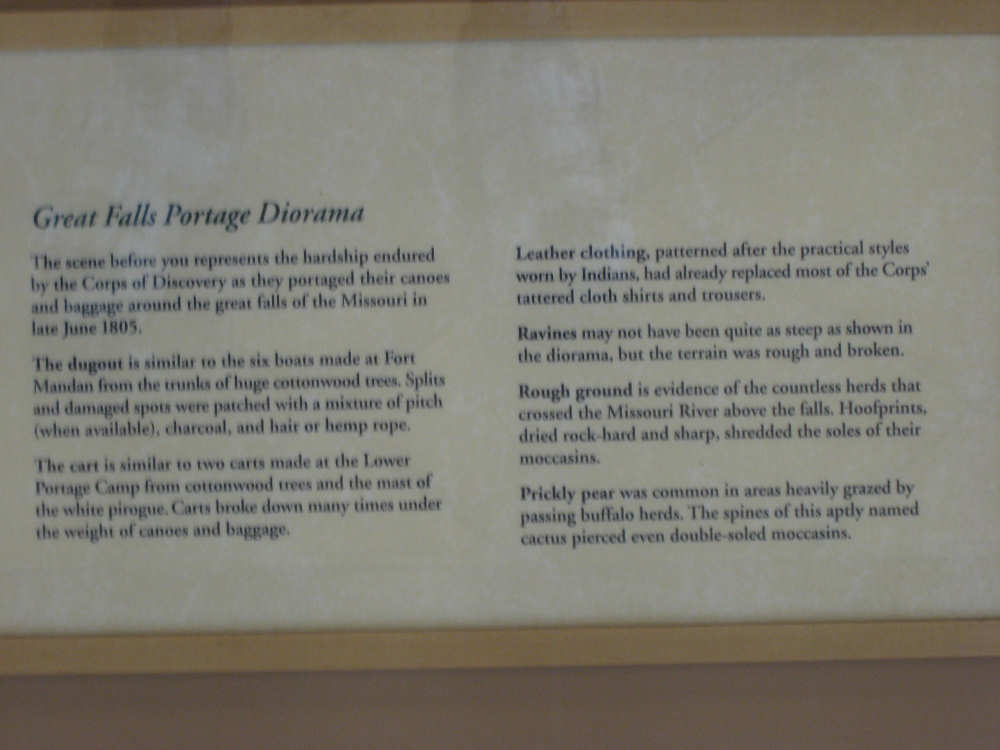
The top of the life-size diorama of the portage around the Great Falls |

Part-way down the diorama |

The full length of the diorama |
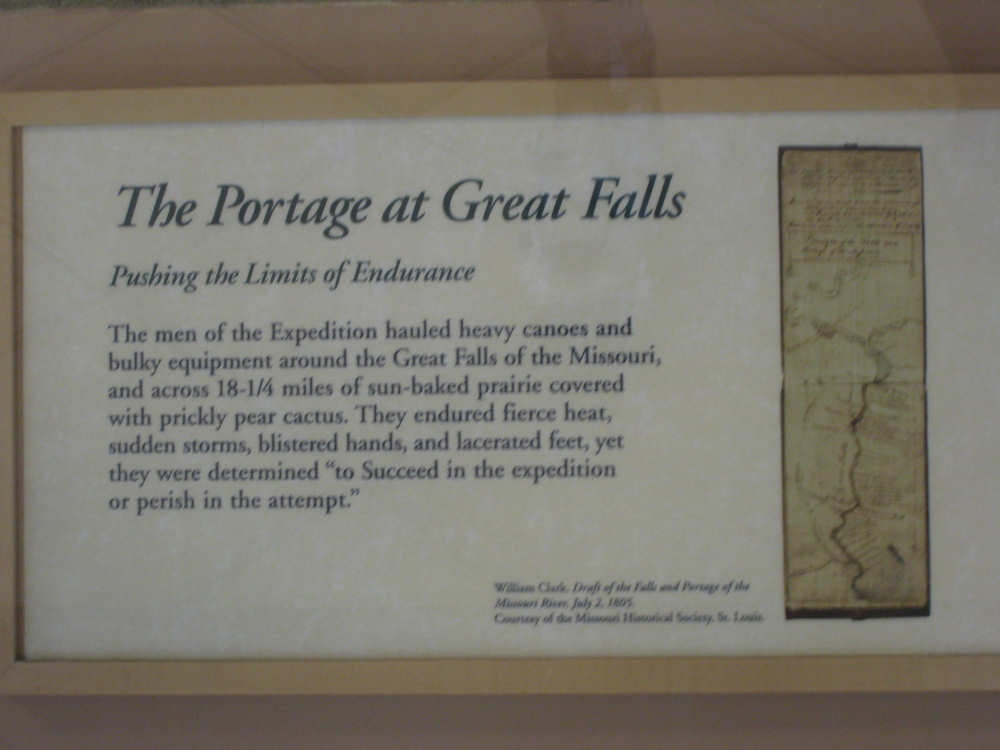
Description of the portage |
|
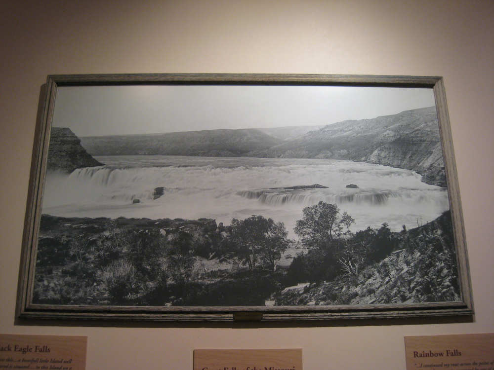
An old picture of the Great Falls show how rough the terrain was |
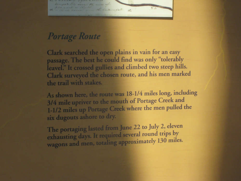
Description of the portage... |
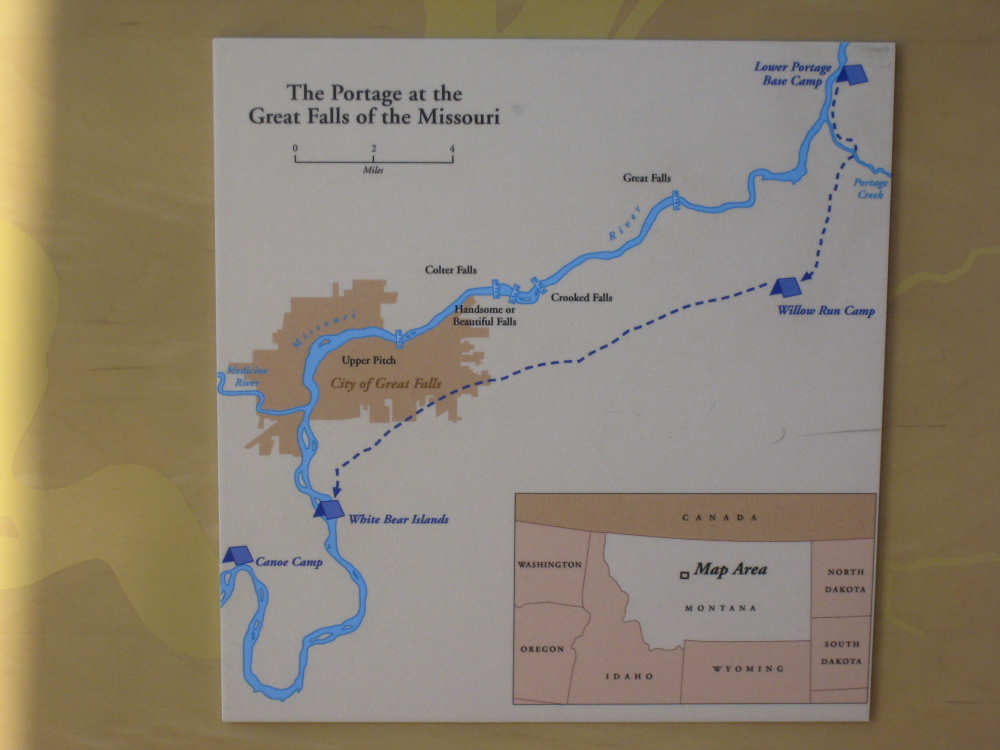
and map of the route |
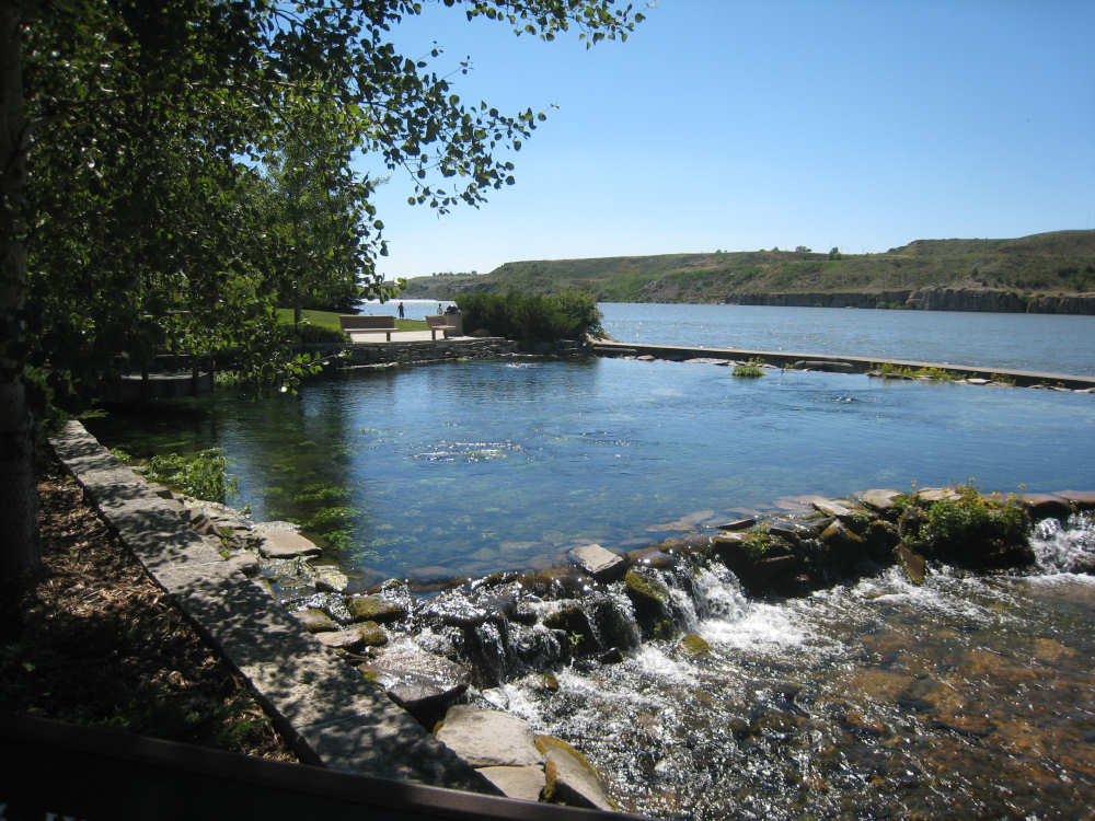
The Giant Springs... |
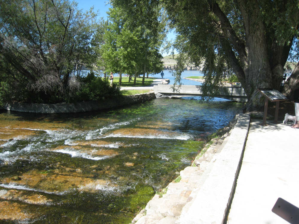
and its entry into the Missouri River |
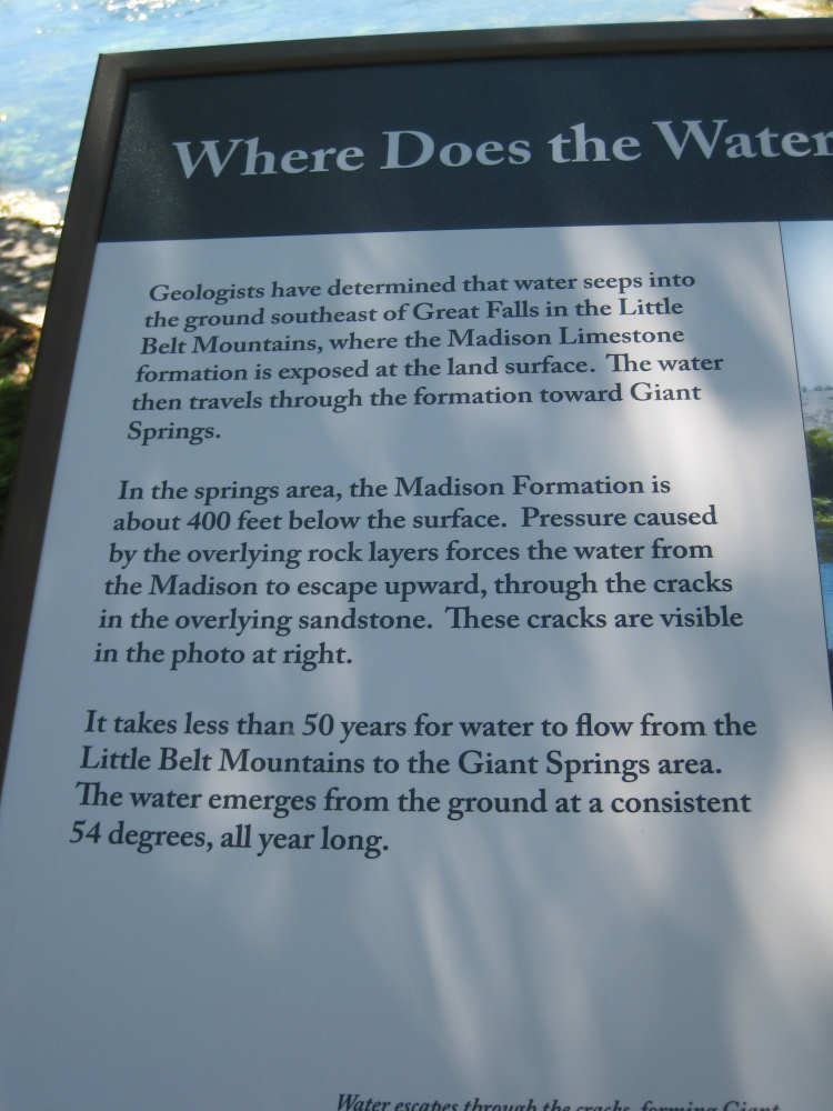
Explanation of the water's source... |
and the water itself |

Looking straight down into the spring water |

Another view of the surface of the spring |